![](/images/other/stat-length.png)
![Excursión Senderismo La Roche-Jaudy - Autour de Hengoat - Photo](https://media.geolcdn.com/t/1900/400/ext.pjpeg?maxdim=2&url=https%3A%2F%2Fservices.sitytrail.com%2FGeolivesWS%2FDownloadMedia.ashx%3FTrailID%3D112654%26Media%3D11382_2.jpg)
Autour de Hengoat
tracegps
Usuario
![Longitud](/images/other/stat-length.png)
![Altitud máxima](https://static1.geolcdn.com/siteimages/upload/files/1508320355ic_sort_altitude_max_24dp.png)
![Desnivel positivo](https://static1.geolcdn.com/siteimages/upload/files/1508320355ic_sort_den_pos_24dp.png)
![Km-Effort](/images/other/stat-length.png)
![Altitud mínima](https://static1.geolcdn.com/siteimages/upload/files/1508320355ic_sort_altitude_min_24dp.png)
![Desnivel negativo](https://static1.geolcdn.com/siteimages/upload/files/1508320355ic_sort_den_neg_24dp.png)
![Boucle](https://static1.geolcdn.com/siteimages/upload/files/16400158638029165_repeat_loop_refresh_sync_direction_icon.png)
![Senderismo](https://static1.geolcdn.com/sitytour/trail-icons/101.png)
2h30
Dificultad : Medio
![Escanee este código QR para abrir la excursión en la aplicación SityTrail](https://capi.geolives.com/qq0zvz2zws4bq2lad0pu/sitytour/trails/112654/qr.png?size=200)
Aplicación GPS de excursión GRATIS
A propósito
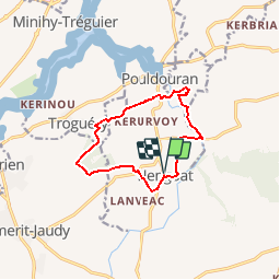
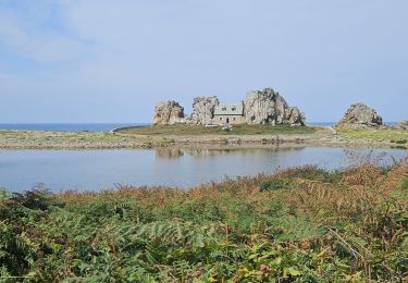
Ruta Senderismo de 10 km a descubrir en Bretaña, Côtes-d'Armor, La Roche-Jaudy. Esta ruta ha sido propuesta por tracegps.
Descripción
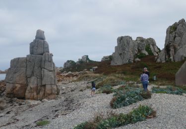
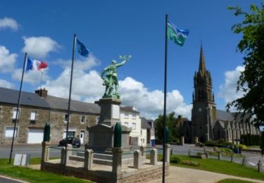
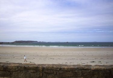
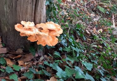
Une trentaine de communes portent le label "Communes du Patrimoine Rural de Bretagne" et mettent en commun leur volonté de sauvegarde, de mise en valeur et d'animation de leur patrimoine architectural et paysager. Des circuits de randonnées pour les uns, des balades champêtres pour les autres vous feront découvrir les bourgs et les villages de caractère de nos communes... HENGOAT, petite commune rurale du Trégor, se caractérise par un bocage largement préservé, fait de chemins creux, de talus murs, d’un boisement encore dense, de sites sauvages autour des zones humides et par un patrimoine de pierres diversifié et typique (corps de fermes, église, pigeonniers, lavoirs, fontaines, routoirs à lin, calvaires, puits…). Bocage, pierre et eau sont les trois atouts patrimoniaux d’une commune discrète qu’il faut apprécier en randonnant paisiblement. Départ de l'église de Hengoat. Retrouvez la fiche du circuit sur le site des Communes du Patrimoine Rural de Bretagne.
Localización
Comentarios
Excursiones cerca
![Excursión Senderismo Trédarzec - Trédarzec - GR34 St-Laurent Kerbors - 26.9km 295m 6h10 (50mn) - 2024 06 25 - Photo](https://media.geolcdn.com/t/375/260/00aa8c28-132a-4856-a45a-3f89b6494ed1.jpg&format=jpg&maxdim=2)
![Senderismo Senderismo](https://static1.geolcdn.com/sitytour/trail-icons/101.png)
Senderismo
![](/images/other/stat-length.png)
![](https://static1.geolcdn.com/siteimages/upload/files/16400158638029165_repeat_loop_refresh_sync_direction_icon.png)
![Excursión Senderismo Trédarzec - Trédarzec Traou Meur - Tréguier Plouguiel la Pointe Jaune GR34 - 22km 340m 5h05 (1h) - 2024 06 24 - Photo](https://media.geolcdn.com/t/375/260/f30e8b12-8ce3-4f56-a62a-68dcabd9bb1a.jpg&format=jpg&maxdim=2)
![Senderismo Senderismo](https://static1.geolcdn.com/sitytour/trail-icons/101.png)
Senderismo
![](/images/other/stat-length.png)
![](https://static1.geolcdn.com/siteimages/upload/files/16400158638029165_repeat_loop_refresh_sync_direction_icon.png)
![Bici eléctrica Bici eléctrica](https://static1.geolcdn.com/sitytour/trail-icons/205.png)
Bici eléctrica
![](/images/other/stat-length.png)
![](https://static1.geolcdn.com/siteimages/upload/files/16400158638029165_repeat_loop_refresh_sync_direction_icon.png)
![Bici eléctrica Bici eléctrica](https://static1.geolcdn.com/sitytour/trail-icons/205.png)
Bici eléctrica
![](/images/other/stat-length.png)
![](https://static1.geolcdn.com/siteimages/upload/files/16400158638029165_repeat_loop_refresh_sync_direction_icon.png)
![Excursión Senderismo Quemper-Guézennec - Le long du Trieux et du Leff - Photo](https://media.geolcdn.com/t/375/260/ext.jpg?maxdim=2&url=https%3A%2F%2Fservices.sitytrail.com%2FGeolivesWS%2FDownloadMedia.ashx%3FTrailID%3D118717%26Media%3D12902_3.jpg)
![Senderismo Senderismo](https://static1.geolcdn.com/sitytour/trail-icons/101.png)
Senderismo
![](/images/other/stat-length.png)
![](https://static1.geolcdn.com/siteimages/upload/files/16400158638029165_repeat_loop_refresh_sync_direction_icon.png)
![Excursión Senderismo Tréguier - Autour de Tréguier - Etape 1 - Photo](https://media.geolcdn.com/t/375/260/ext.jpg?maxdim=2&url=https%3A%2F%2Fservices.sitytrail.com%2FGeolivesWS%2FDownloadMedia.ashx%3FTrailID%3D105811%26Media%3D9733_5.jpg)
![Senderismo Senderismo](https://static1.geolcdn.com/sitytour/trail-icons/101.png)
Senderismo
![](/images/other/stat-length.png)
![](https://static1.geolcdn.com/siteimages/upload/files/16400158638029165_repeat_loop_refresh_sync_direction_icon.png)
![Excursión Senderismo Ploëzal - la roche jagu - Photo](https://media.geolcdn.com/t/375/260/8b43e6f7-3121-4717-827d-42251933622c.jpg&format=jpg&maxdim=2)
![Senderismo Senderismo](https://static1.geolcdn.com/sitytour/trail-icons/101.png)
Senderismo
![](/images/other/stat-length.png)
![](https://static1.geolcdn.com/siteimages/upload/files/16400158638029165_repeat_loop_refresh_sync_direction_icon.png)
![Excursión Senderismo Pleumeur-Gautier - La Licorne après midi - Photo](https://media.geolcdn.com/t/375/260/5650fed4-39b0-4e66-9351-54919f5c1bc0.jpg&format=jpg&maxdim=2)
![Senderismo Senderismo](https://static1.geolcdn.com/sitytour/trail-icons/101.png)
Senderismo
![](/images/other/stat-length.png)
![](https://static1.geolcdn.com/siteimages/upload/files/16400158638029165_repeat_loop_refresh_sync_direction_icon.png)
![Excursión Senderismo Tréguier - RA 2023 Tréguier Plougrescant - Photo](https://media.geolcdn.com/t/375/260/834380ca-66a7-4816-bb7b-8d748b9fa5e1.jpg&format=jpg&maxdim=2)
![Senderismo Senderismo](https://static1.geolcdn.com/sitytour/trail-icons/101.png)
Senderismo
![](/images/other/stat-length.png)
![](https://static1.geolcdn.com/siteimages/upload/files/16400158638029165_repeat_loop_refresh_sync_direction_icon.png)